14 in 2014: The Epic, the Mud and the Cloud Cover

Nippletop Summit

Nippletop Summit

Who can believe it that hiking season came to a close a month ago. I’m still feeling the itch to be back on the trail but with the short (and cold) days I’ll have to satisfied with dreaming/planning of next season in the months to come.

I started the hiking season with six ADK46 under my belt and added another 14 over nine hikes. Yep I’m at 20. My goal was to hike 11 this season so I’m feeling pretty good about it. Nearly half of those hikes I had cloud cover for either the summit or for the whole hike. Damn you mother nature for not adhering to my pre-determined schedule! But that’s the deal when you have limited weekends to make the trek and that whole full-time job getting in the way.

So without any further delay here’s my re-cap of the 2014 season, ranking in order, starting with my favorite. O.K. actually one delay – a note on the ranking order. Some get low ratings because the view was pretty crappy on the day I hiked it (a.k.a complete cloud cover) but on a clear day I know would have been amazing (particularly Rocky Peak Ridge). I’ve never believed in sliding scales so they get no points for how I would have ranked them given better weather conditions. My rankings are  capricious and unfair but generally based on how much reward for effort (and perhaps some bias against a certain private rd.) Continue reading

Posted in Uncategorized | Tagged , , , , , , , , , , , , , , , , , , | Comments Off on 14 in 2014: The Epic, the Mud and the Cloud Cover

Intro to the Dix Wilderness: Macomb Mountain

1636
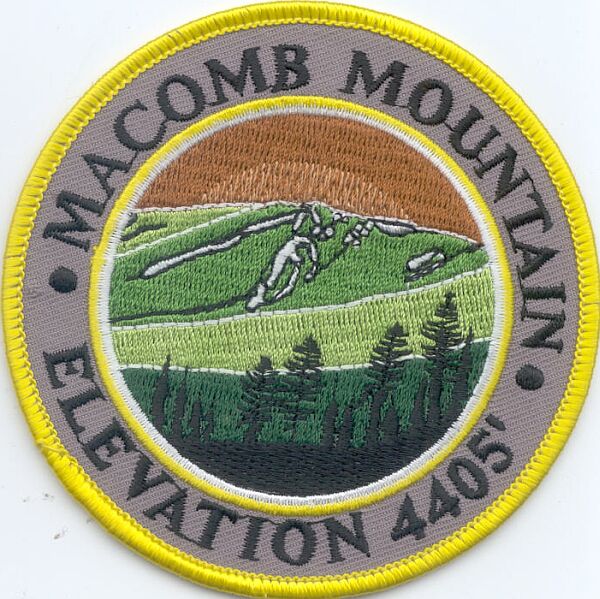
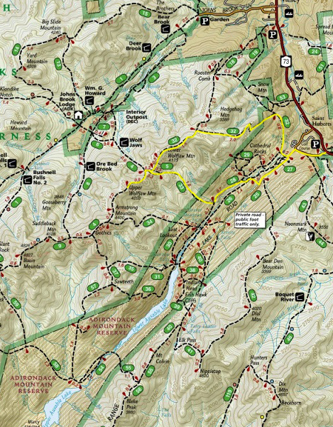
Following up on my hike up Mt. Marshall on Saturday I took advantage of the three day weekend and squeezed in one last trek. Macomb is my first venture into the Dix Wilderness and the Elk Lake Trail.

Early Big Game Hunting Season starts the weekend after Columbus day so this was my last ADK46 hike of the year. I don’t know about you but I’d prefer to stay clear of  hunting areas, particularly when by myself. Don’t get me wrong – I totally support multi-use of land and hunting season. I just stay clear of wildness when the guns are out.

2014-10-13 10.03.07Like many of the peaks in the ADKs there many combinations to hiking the Dix Range: Dix, Grace Peak (formerly E. Dix), South Dix, Hough and Macomb. All but Dix are trail-less (i.e. unmaintained herd paths). Though possible to do in one continuous hike – it rarely is done together without camping – and I have doubts that I’d have the speed to safely do all five in one long day. So my plan was to break it out in three hikes: (1) Macomb (2) Dix and (3) Grace, South and Hough. Macomb was the perfect intro to the Dix Wilderness and chance to get a “short” hike in. Though short does not translate into easy. The last 1.6 miles rises up 2200 feet on some difficult terrain.

The Elk Lake Trail is accessed via the Elk Lake Lodge Road (private). For a bit I questioned if I was on the correct road – it went much farther than I excepted with no signs of hikers but finally I saw the tell tale signs of cars parked on the road indicating a full trail head parking lot. I was relieved to find several open spots – guessing most of the cars were weekend camping backpackers.

2014-10-13 10.53.30
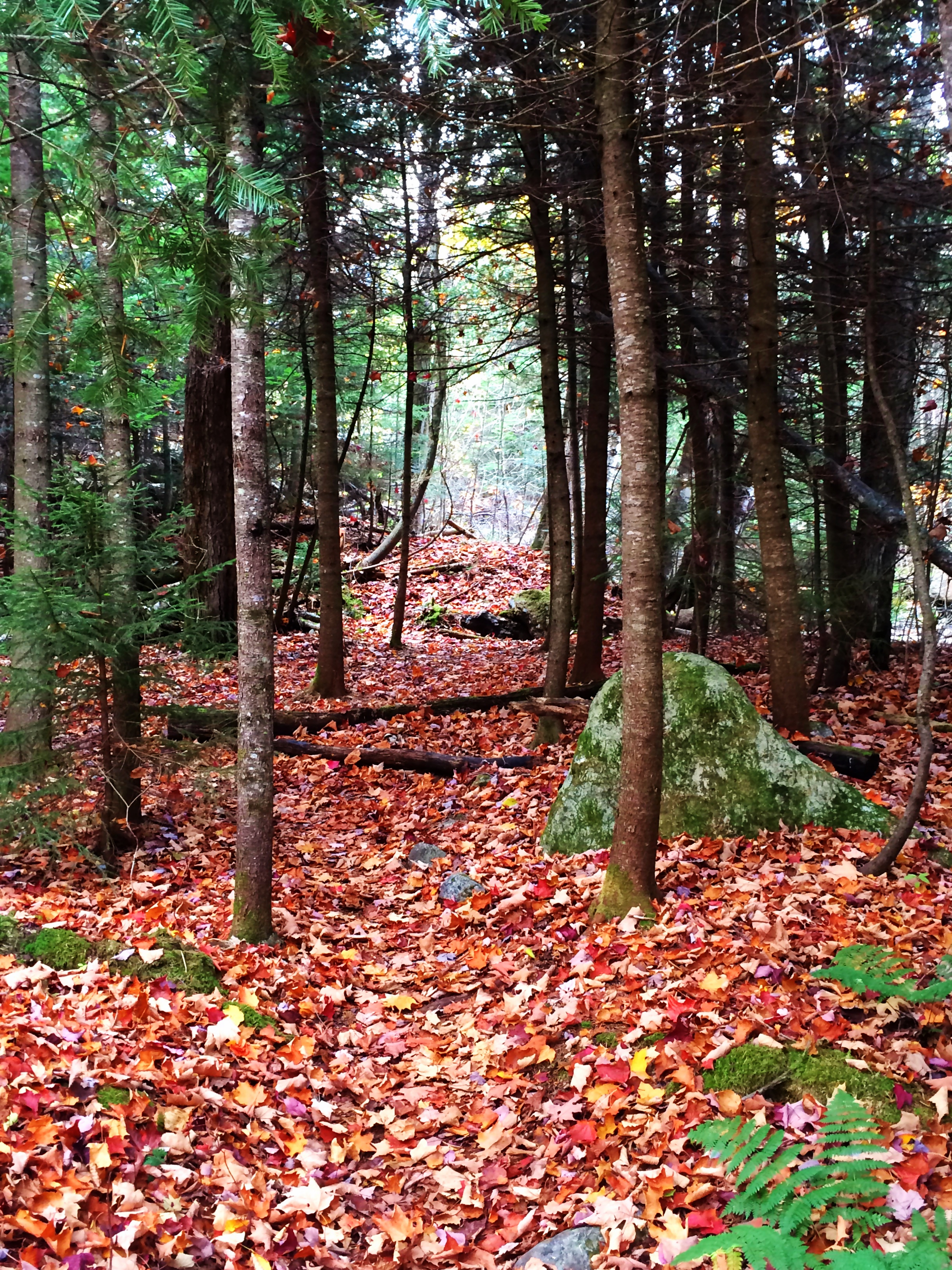
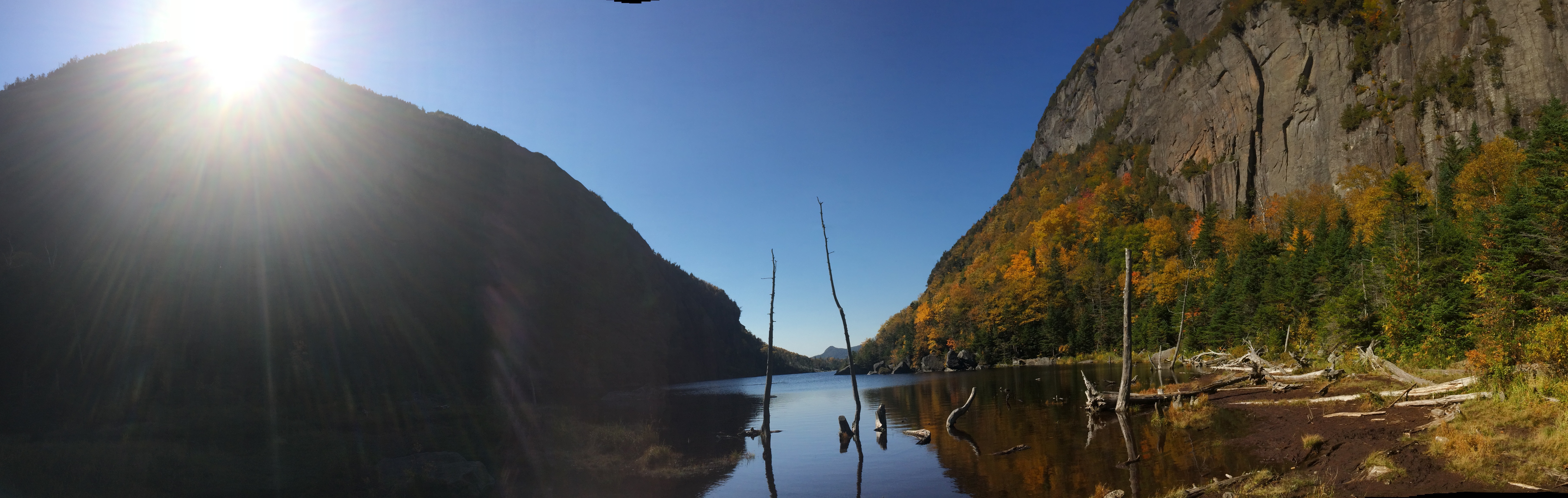
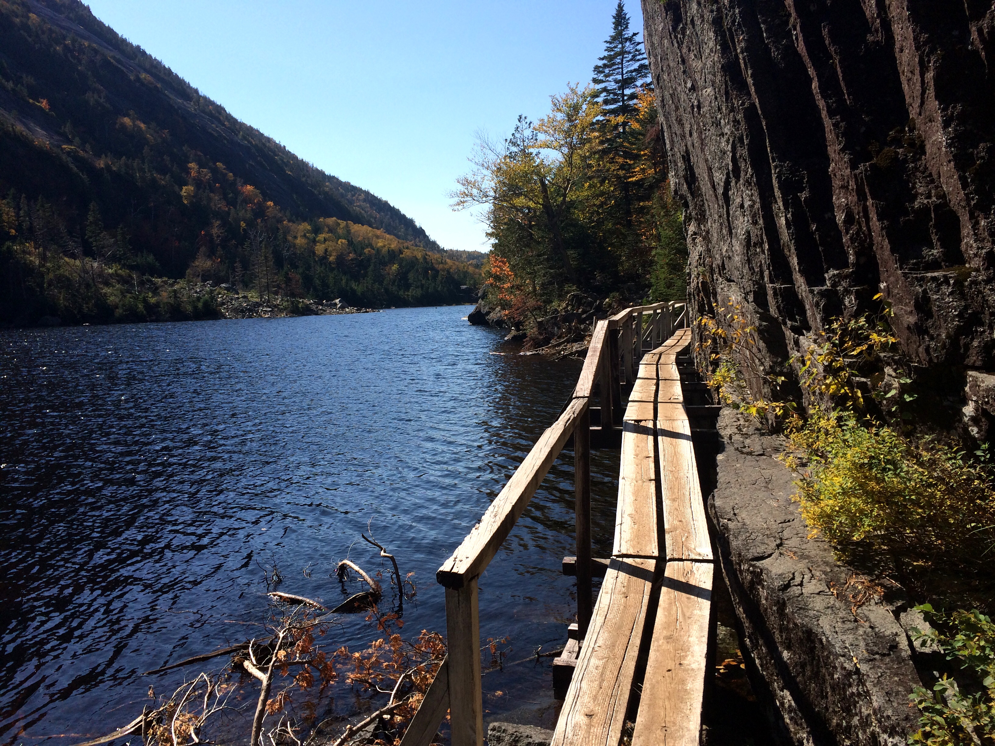
The first 2.3 miles flies by:  relatively flat, with some gentle rises and falls, a pretty worn trail, with a few rock hopping sections, crossing first Big Sally Brook and several other small brooks before reaching the unmarked trail (ok actually marked by a cairn) just after Slide Brook. Unlike, Marshall the trail is easy to follow (even with the trail covered in leaves) and the first mile is a beautiful forest hike, with some elevation gain but nothing too steep relative to most ADK hikes. Also some nice peeks at South Dix and Grace on the way up.

2014-10-13 13.12.26
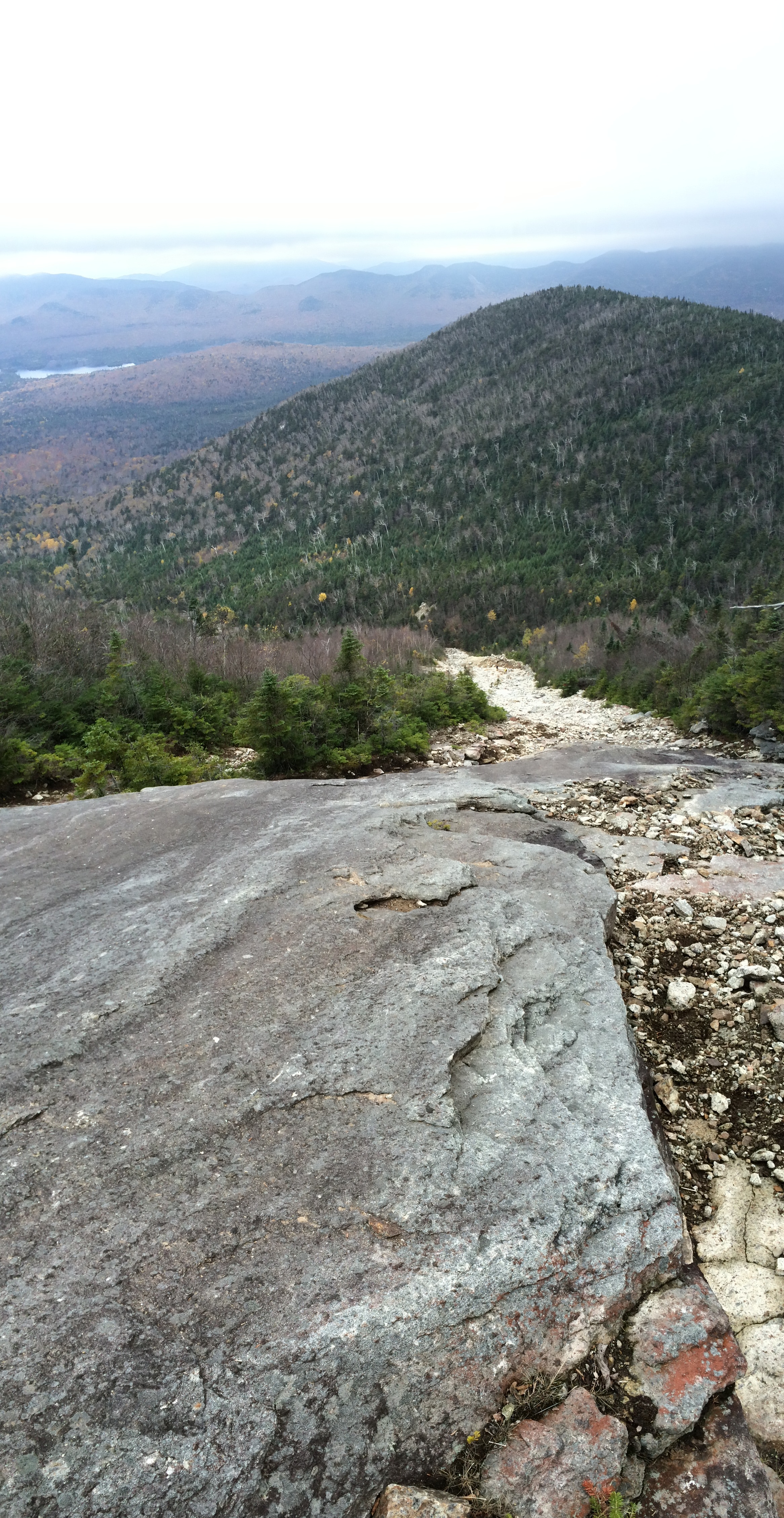
But then you hit the slide – oh boy it is certainly one of the most interesting sections of hike. But easy isn’t what I’d call it. The first part of the slide is quite loose (read: lose rock and dirt that slides all around you as you make your way up that gives you the feeling that if you slip you’ll keep going). Angling left puts you on firmer scrambles but steep and slippery/wet on this day – I opted for a combination on wet scramble and the loose rock in sections depending which footing seemed less treacherous. All that said – it was very unique and awesome. With great views of the Elk Lake region stretching below, gave some views when resting. Which was good because the summit was in cloud cover.

Eventually reaching the tree scrub to a higher and steep section of the slide that ends with a transverse under a huge boulder. From there joins the less used (longer trail from the slide) to transverse the ridge just south of the summit.

2014-10-13 12.16.15
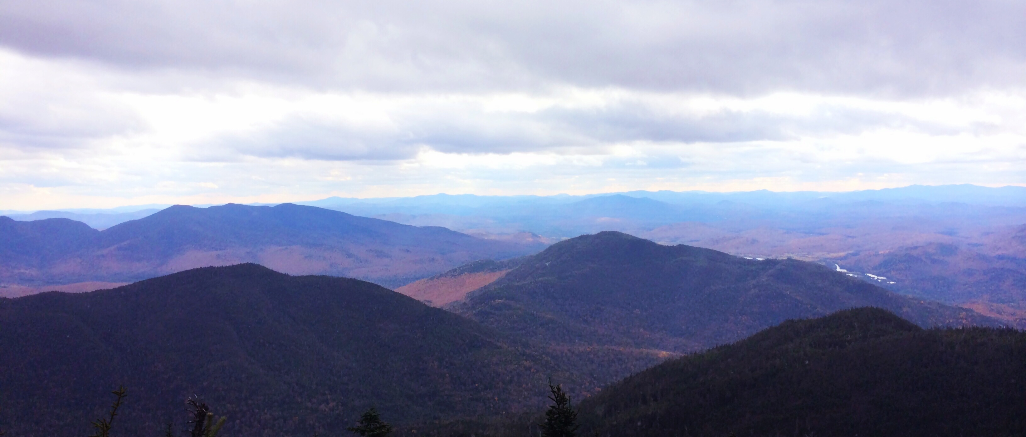
The view from the top, well, was non-existent. Cloud cover through and through. But I still enjoyed a quick break before heading back down to the slide and enjoyed my lunch break below the cloud cover and the view.

Ascending the slide took some time, and probably could of picked a more efficient path – but considering there is no “path” it wasn’t self-evident to determine the best option. At times rock climbing down the edge of scrambles where they met the brush line. But I finally found a good switchback option about half way down in the more “loose” section. Witnessing one hiker slip – I watched the rocks tumble down and sure made me thankful I was above him and not below. It was also reassuring to see he only slid about 5-10 feet vs. the horrific tumble I was expecting to see. Continue reading

Posted in Uncategorized | Tagged , , , , , , , , , , , , , , , , , , , , , | Comments Off on Intro to the Dix Wilderness: Macomb Mountain

Mud Madness: Mt Marshall

2014-10-11 14.42.06With daylight hours running short and few hiking days left I decided to tackle a single mountain and get another “trail-less” peak off my list. Mount Marshall probably isn’t one of my favorite hikes – but still enjoyed some nice lake views, waterfalls, fall foliage, snow flurries, mud, mud swamps, mud lakes and, well, more mud. Did I mention it was muddy?

Mount Marshall: Flowed Lands

Mount Marshall: Flowed Lands

It was my first hike at the Upper Works Trailhead and while mileage wise not that much farther from my house took an extra hour to get there. Yep that makes for a longer day and eats up precious daylight.

The Calamity Brook Trail is relatively easy and mostly flat hike in, with some less than ideal footing at various points but  a nice resting spot at Flowed Lands. I thought it would be the muddiest portion of the hike with having to balance on logs on more than one occasion. Boy was I wrong. It is then one mile in –  skirting around the lake, some elevation gain and just after crossing Herbert Brook to the split off to Mt. Marshall. Note to self: pay very close attention to not miss the turn off that is only noted by the cairns (aka pile of rocks). Now at 5.7 miles in and only just getting started on Mt. Marshall. Seriously?! 5.7miles just to start. I guess it wouldn’t be a ADK46er otherwise.

2014-10-11 13.18.54Cold Brook Trail is the most commonly used for Marshall but I went up via Herbert Brook offering far prettier views. Only 1.5 miles and 1500+ feet to go but it was slow going the whole way up. Starts out easy footing and elevation but the fall foliage and leaves on the ground made for a slow pace to keep on the “path”. Once you start crossing Herbert Brook figuring out if and where to cross took more time than I thought. Then it got real.

Steep elevation change with a muddy and slippery path which then lead to mud swamps/lakes. No joke. I used my hiking pole as a test for how solid it was and at times it’d go in nearly the full length of my pole. Yeah, I may have utilized some bushwhacking skills to skirt that.

2014-10-11 12.47.17The last pitch up hit colder temperatures with flurries flying and some limited views of Iroquois to the north. One last fun scramble to the obscured summit in the trees. But a viewing ledge on the south side gave great views – even on a snow flurry, over cast day. I didn’t have the time to linger but could have soaked it in for much longer. A quick refueling snack and a few pics and I was on my way.

The hike down Marshall flew by, as did the first few miles on the main trial. I wanted to get to 1.6 miles from the trailhead before dark. The section prior isn’t steep but required balancing on logs over mud, river crossings and the footing was filled with boulders and rocks – not as ideal for the dark. I missed it by about 20 min which wasn’t the end of the world. Yep. Glad to have that head lamp (and to see other hikers doing the same). Continue reading

Posted in Uncategorized | Tagged , , , , , , , , , , , , , , , , | Comments Off on Mud Madness: Mt Marshall

Epic: Mount Colden, Avalanche Pass & Fall Foliage

2014-09-27 15.09.57Nothing says hiking the ADKs like Fall Foliage Season. It is prime time so I decided to do an epic 16 mile loop from ADK Loj, through Avalanche Pass, past Lake Colden, up “Misery Mile” to Mount Colden Summit and down via Lake Arnold.

This hike has it all: three lakes, deep forests, high cliffs, bridges attached to a cliff face, fall foliage, some serious elevation gain to kick your ass (a.k.a. misery mile) and one hell of a summit view. Has to be one of my favorite and most unique loops to date. It is the hard way up but well worth it!

I had a few hiccups in the morning that pushed me out on the trailer a bit later than I like to be, especially this time of year with the shorter days. Note to self the Essex/Charlotte Ferry is now on fall hours so while I wasted prime daylight, then found out the next ferry wasn’t coming for an hour (on to the bridge). And who would of thought the parking lot would of been full before 8am! Yep that added an extra two mile round trip to my hike.

2014-09-27 09.39.41But after that the first few miles go by quick to Marcy Dam. It’s mostly flat, well worn and pretty – albeit too much traffic for my taste. But some very nice fall foliage.

Then heading off to Avalanche Pass Trail. It has a couple of steep pitches, and some rocky sections (a.k.a. slow moving for footing) but for the most part it is easy going until you hit Avalanche Lake. It was simply breathe taking. I spent my sweet time enjoying the Lake, views, the bad-ass bridges hitched to the side of the cliffs, and generally enjoying the moment. Being 5+ miles in it gives you the illusion you’re making great time. Oh just wait until Misery Mile (more to come) and in fact it is all about the elevation change and nothing to do with mileage. Why must I keep learning this lesson?!

2014-09-27 11.17.33

2014-09-27 11.43.45Once past Avalanche Lake it is a quick jaunt past Lake Colden. Yes, another beautiful view and the logs “bridges” right on the edges of the lake before splitting off to go up to the summit.

Now 6+miles and only 1.6 to go to the summit – however nearly all the elevation change is in less than a mile of that. Misery Mile is no joke. About 2000 feet in elevation gain in a grueling, unrelenting, steep climb.  Not to mention that it was wet and slippery. Yep, I earned my view in this section. The Lake Arnold route is by far easier but Avalanche Pass and Lake Colden make this route  one of the most spectacular and interesting circuits in the ADKs. Continue reading

Posted in Uncategorized | Tagged , , , , , , , , , , , , , , , , , , | Comments Off on Epic: Mount Colden, Avalanche Pass & Fall Foliage

Dial and Nippletop: Sun at last!

Nippletop Summit

Nippletop Summit

I’ve had a rough run of it the past couple of hikes with cloudy, over-cast hikes. Unless, you can be flexible and hike mid-week depending how the weather is shaping up that is just how it goes. But the last weekend in August brought exactly what I needed – a beautiful day for a perfect hike.

I tackled Dial and Nippletop and another long, flat walk down Lake Road off Ausable Club. This is my last hike off Lake Road and boy I’m not going to miss that extra mileage. I ascended up via Henry Goddard Leach Trail which was a lot easier than I thought it was going to be. Don’t get me wrong there are a few steep sections that just keep a steady climb up and your calves certainly feel it. But the footing is smooth and easy. No searching for foot holds up scrambles or having to walk over loose rocks. And a couple of nice break points for views. And while the fire on the shoulder of Noonmark Mountain is a shame it gave a nice contrast with some new growth forest and a clear view before the col to Bear Den Mountain (I kept calling it Beer Dean. I guess I know what was on my mind).

Dial Summit

Dial Summit

Continue reading

Posted in Uncategorized | Tagged , , , , , , , , , | Comments Off on Dial and Nippletop: Sun at last!

The Jaws: Upper and Lower

LWJ UWJ Trail HighlightAnother weekend meant another chance to climb, albeit not the best weather I could of asked for. When summit reports were saying temperatures were dropping to the 20s and 30s  I thought they were exaggerating. Calling for winter hats and gloves, in August?! But with 45 degrees at one summit and under the 40  on the other I’m glad I brought my vest, hat and gloves. It was chilly! It’s odd to be in shorts and a tank top and then all of sudden huddling under your winter cap. Yep that’s the adirondack weather for ya.

I headed up to Lower Wolfjaw first, skipping the Lake Road and ascending via W.A. White Trail. The summit view was, well non-existent, not that it is known for being one of the best. But I knew that was going to be the case, so it gave me a chance to really appreciate the beauty of the trail – because you sure aren’t going to see anything at the top.

WA White Trail to Lower Wolfjaw

WA White Trail to Lower Wolfjaw

The ascent was pretty straight forward, some wet spots and one particular mile that was quite nice – enough of a climb to make you sweat but easy enough that you could book it pretty fast and still enjoy the deep forest that was all around you. And a couple of spots of pretty steep elevation gain – once early on and then once at the very end that you are basically climbing up a vertical rise in a rock-face, muddy, gully. Oh joy!

The only thing I did not appreciate was the bear scat and tracks. Yep. I was that that solo hiker that was singing on the trail to make sure to make enough noise to not startle a bear. I apologize to any wildlife that had the mis-fortune of hearing me sing. Don’t get me wrong I like wildlife. But bears, I prefer to see them at a distance. The Ranger said there was 7 sightings on Saturday and expected more. Continue reading

Posted in Uncategorized | Tagged , , , , , , , , , | Comments Off on The Jaws: Upper and Lower