
 I’ve been putting Allen off, so much so, that it is my 45th climb. Nothing like saving it for the near end. But with so much history for my family Whiteface was destined to be my final peak. I’ve heard horror stories of Allen’s difficulty, length, mud and red-slime. It was one hike I was not looking forward to.
This is considered the most difficult peak of the Adirondack 46 simply because it is such a long hike over confusing forest and logging roads to get to just the base of the peak to start climbing. — EveryTrail
The longest 46’er, complete with long, boring trails, six River crossings, a slide filled with slippery red slime and four gorgeous viewpoints. 19.5 miles, RT. Expect this hike to take anywhere from 12 to 15 hours. — High Peaks MeetUp
But really I didn’t find it that bad. Sure it isn’t a walk in the park – but compared to Redfield and Cliff I found it much easier. And I didn’t find the trail difficult to follow in the least. Perhaps, a different time of year the turns would be harder to pick-up on or I’m just used to the herd paths by now.
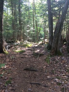
Starting with the Hanging Spear Falls Trail approach (trail 128) you hike in 5.5 miles, before reaching the herd path. It’s fast going with varying trails, gravel paths, river crossing, but all in all, very easy and fast going. Some rolling ups and downs, and not heavily marked, but I found it very intuitive. In hindsight, I which I had jogged in and saved some time.
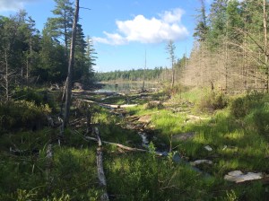
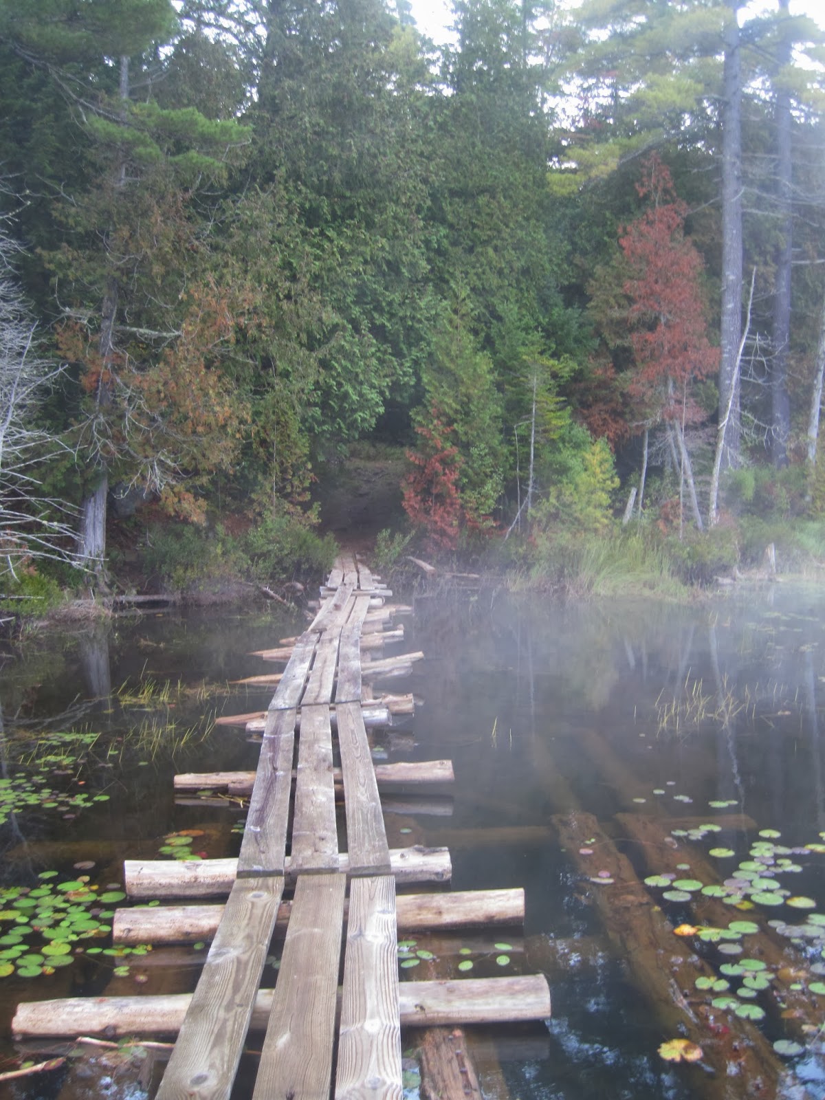
 At .1 miles you come to the Hudson River – and a suspension bridge (yay!). Continuing on the path you’ll reach Lake Jimmy at .6 miles. There used to be cool floating bridge but that is very much defunct now (Note: most trail books still refer to the bridge). At .9 miles you’ll reach an abandoned observer’s cabin, and turn R to keep on the trail. And at 1.1 the split to go to Mount Adams.
From here the trail has a few different turns, views of Lake Sally to your right, goes between trail, to gravel, sand, a few muddy (but slight) sections. There’s a final view of Lake Sally at 2 miles. And at 2.9 miles you’ll reach a gate (used to be private property but now marks the boundary between Forest Preserve and Nature Conservancy land). Paying attention to the various turns, will save you time on the return trip and needing to reference trail descriptions. Like I said earlier, I found it very easy to follow but there are not the same amount of markings that we have become accustom to.


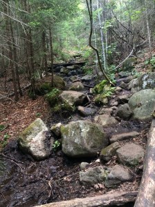
 At 3.8 miles you’ll cross the Opalescent River. Some descriptions refer to a bridge – but there is none. I saw some indications that one, once existed with anchors in a large boulder further up stream, on the other side. During low water, crossing the ford is no problem at all. It is an easy wade across. I had water shoes, but alas left them in car. (Need more morning coffee). You can make it most the way across while keeping your feet dry (if you go up stream a bit) – but my recommendation is to take your shoes off (if in low water) or bring water shoes. You don’t want soaking wet shoes this early in. I’ve heard high water this can be dangerous, and I’ve learned to respect river crossings.
Keep following the trail and the occasional flagging and you’ll reach the junction with the Allen path at 5.5 miles. There’s a hard left to stay on Hanging Spear Falls/Marcy and soft right/straight for Allen. There is a good marking indicating Allen just past the junction.
This is the most important turns to keep note of for the return trip. After about .3 miles in the herd path turn left at a gravel road (it goes both directions so don’t want to miss on the way back), and then in about 50 yards up turn right into a gravel pit. There’s another trail register, and back to the path.
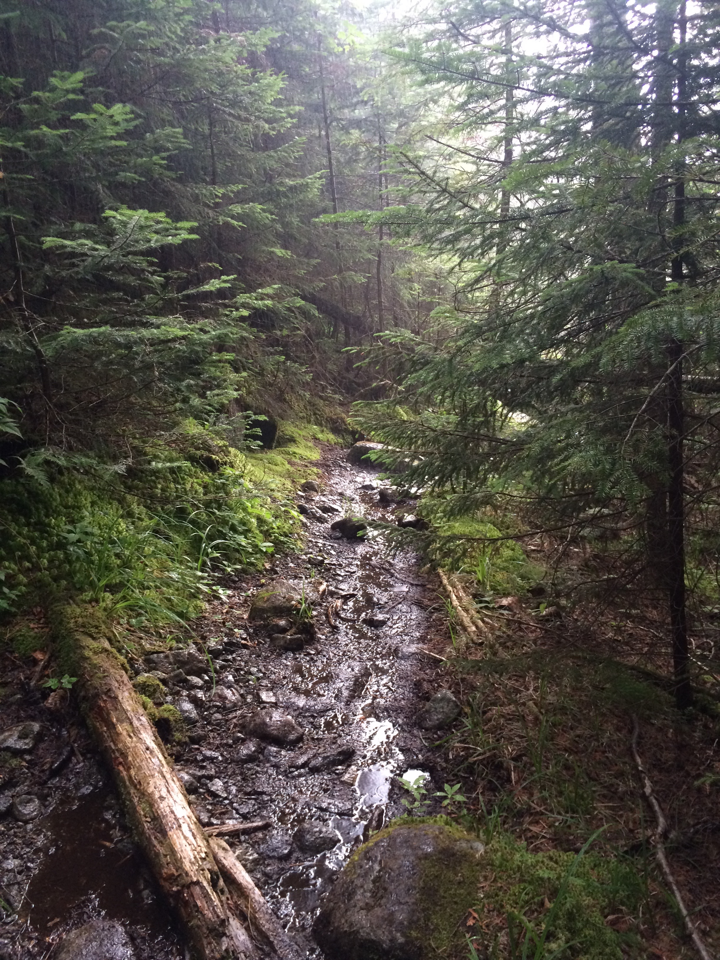
The first 2/3 is moderate, pretty walk/hike in the woods, and easy to follow. Some turns, varying degrees of rolling ascents/descends, wooded, gravel, etc. but I found that is breezed by. Supposedly, there is a waterfall at around .9 – but I saw none. There was a long open chute with water coming down that may have once been a waterfall. I also read descriptions of bever damns and hard blow down, but I saw none indication of them.
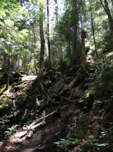

You have a couple of brook crossings, before coming to the final and largest at Skylight Brook. It feels like an ‘actual’ crossing, as opposed to easily rock hopping, but was still easily crossed. (NOTE: during times of high water, Skylight Brook may be impassable.) This is a good point to fuel up if you need it. It took me as long to do the last 1/3 as the first 2/3 of the herd path. Because now it becomes a real climb and as the kids like to say ‘the shitz is about to get realz.’
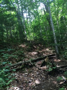
Steady climb up Skylight Valley for about. 7 miles, as you walk parallel to Skylight Brook, although moving away from it. You’ll be in the trees with rough footing and your first real taste of elevation gain. Allen Brook will come in, and you’ll be in and out of the trees and Brook. Varying degree of scrambles, slippery rock, root climbs, etc. You know – the usual steep, herdless climb, I’ve come to bond with in the ADKs.
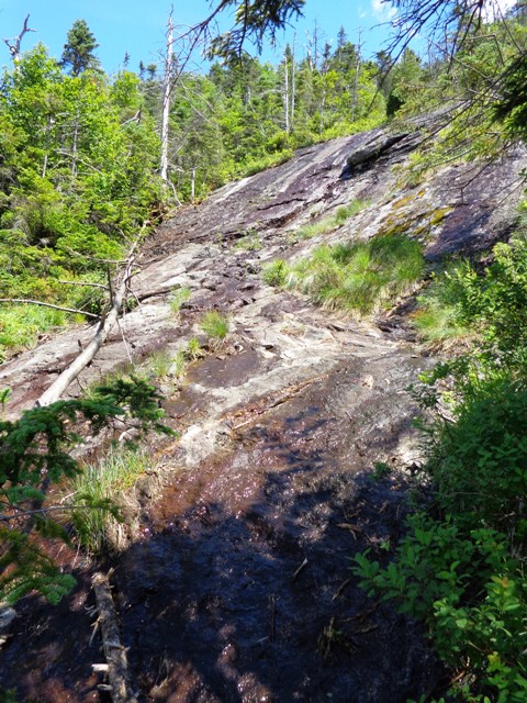 Once you hit Allen’s slide it get’s more challenging. I didn’t find much of the notorious slippery, red slime but it’s there. It was a dry day, and while not totally avoidable, I took my time to find footing. A couple of slippery moments, but nothing that I’d call a close call. Coming down this was even more important.
Past the slide you’ll be in the woods to the left side, with still some climbing to do on lose rock, several scrambles and mud. There’s one last scramble and voila you’re there. Wooohooo! Just about almost 1.3 miles from Skylight Brook but I felt like all my “work” that day was packed right in. And sure felt longer than the distance. I’m not sure how much of the elevation gain is in the last piece, but when I was a little more than 1/2 way up the hard part, a man coming down, said I had another 1,000 ft+ to go. Oh joy.
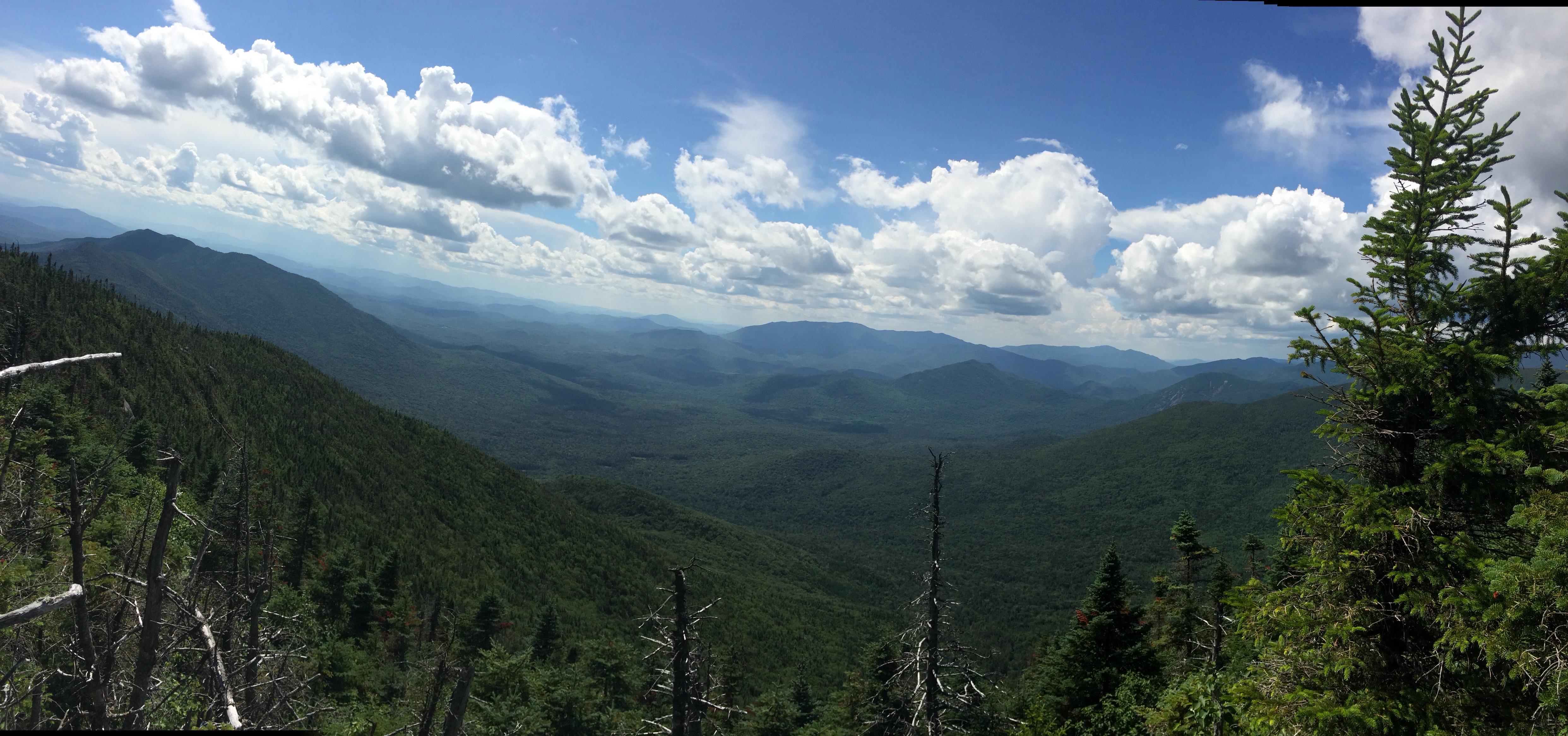
Just past the summit there is a better view, than the enclosed summit. I recommend another spot just before the last scramble on your left (going up) for the best views of the day. Take the time to the explore the summit, there are varying hidden viewing points.
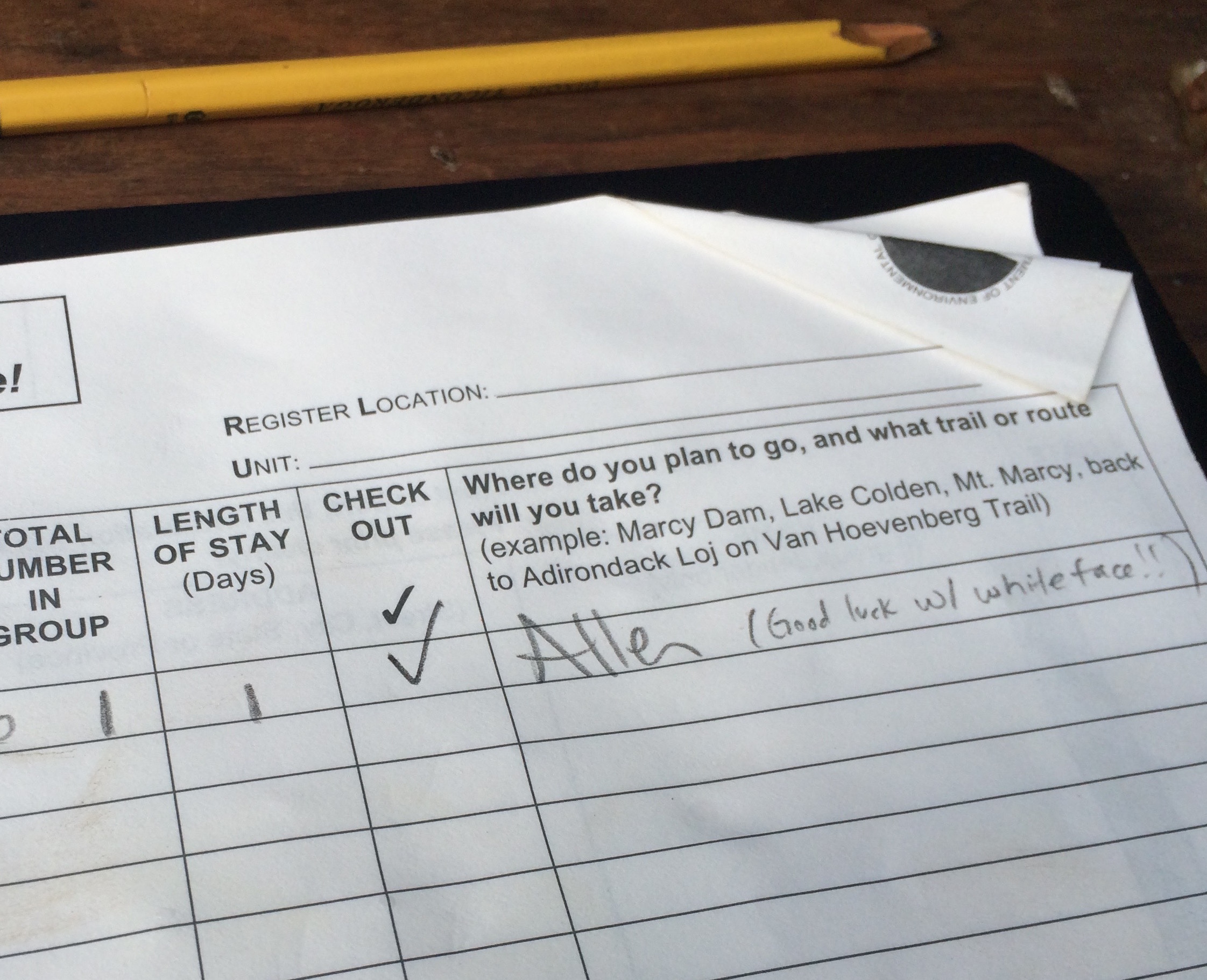 A few memories of the day, was meeting a man hiking down with a group, celebrating his 46. Nice job!! And having chatted with a couple at the parking lot earlier in the day, several people stopped me on the way up, asking if I was the girl who was on #45 to give me high fives. The couple also left me this cute note in the trail register. They were all kinds of awesome and brought a smile to my face numerous times. I simply love the people I meet on the trail and kinship that develops hiking the ADK46.
 I breezed down and was able to avoid an epic storm. I could hear the thunder bellowing in the distance, but I managed to only get about 5-10minutes of rain, that hit when I was perfectly located under a think underbrush and a large tree that protected me. It was actually quite serene and a nice resting spot.
My only regret was just wading through the ford on the way back to shave some time compared to finding the right location on rocks. My water logged shoes were not super comfy and felt 10 lbs. heavier when I was jogging out. #lessonlearned.
Coming out in the light was a real treat after the past couple of long hikes and I was feeling quite chipper for an 11hr hike. But after last week’s hike and my mental preperation for something much harder – it really comes down to expectations and Allen beat them. Doubt that it’ll be a hike I yearn to do over and over but exceeded expectations none the less.
#45 done. Done to the final, the one and only, Whiteface!


