
 As a solo day hiker there are only so many weekends and only so many summits I can ascent in one day. What to do? Renting a cabin in the ADKs to use as a basecamp and save on the drive time seemed like a great hiking vacation – with all the comforts of a camp (i.e. hot showers, hot food and nice cold cocktails).
Oh it is always the best laid plans. Which is to say that my plan of hiking every other day (a total of four hikes) and focusing on the ADK Loj and John Brooks trails didn’t quite happen. Rain and lightening storms will do that. My first hiking day called for steady rain and Saddleback and Basin are two mountains that I do not want to do on wet and slippery days. Panther and Couchsachraga it is!
It is a hike known for being muddy – even in August – and not the epic views of others. I prefer to save the “good” hikes for those clear weather days. And why not trek up a muddy hike after several days of rain to make it extra fun.
The Upper Works trailhead isn’t close to anywhere. Don’t get me wrong the 90min drive from Wilmington was better than my 3 hr+ from Vermont. I just didn’t think I’d still have that kind of drive time with a basecamp in the High Peaks. Oh well.
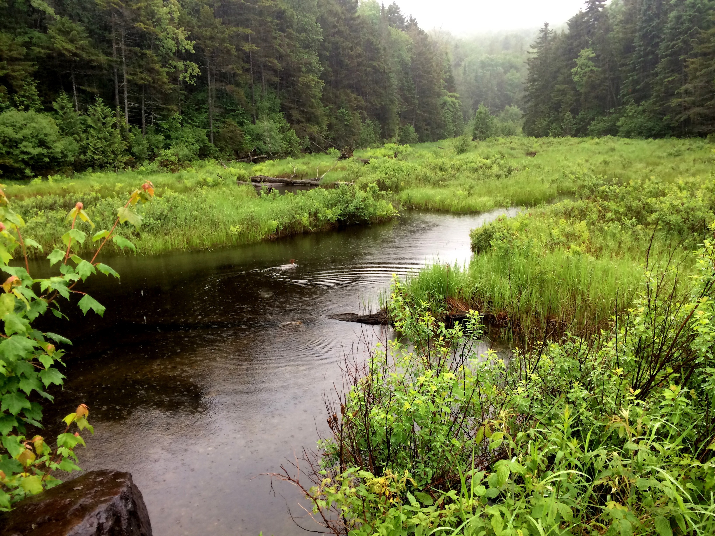
outlet to Harkness Lake
As I started I was the first (and only) car in the parking lot and the first entry in the trail book. That would not change by the end of the day. Starting from the Duck Hole trail it begins easy as pie with a gravel road. At 1.1 miles you cross an outlet to Harkness Lake. I’m told you can see a great view of Wallface Mt. but I only saw clouds. At 1.8 a sharp right off the gravel road where the trail begins and my first taste of mud. But it was nothing to what I would experience by the end of the day.
Tip: If you use bug spray and the strong stuff do not rub your lips after getting it on your hands. And better yet don’t then lick you lips. Your mouth will be numb for a good 30min. On the plus side you won’t be thirsty.
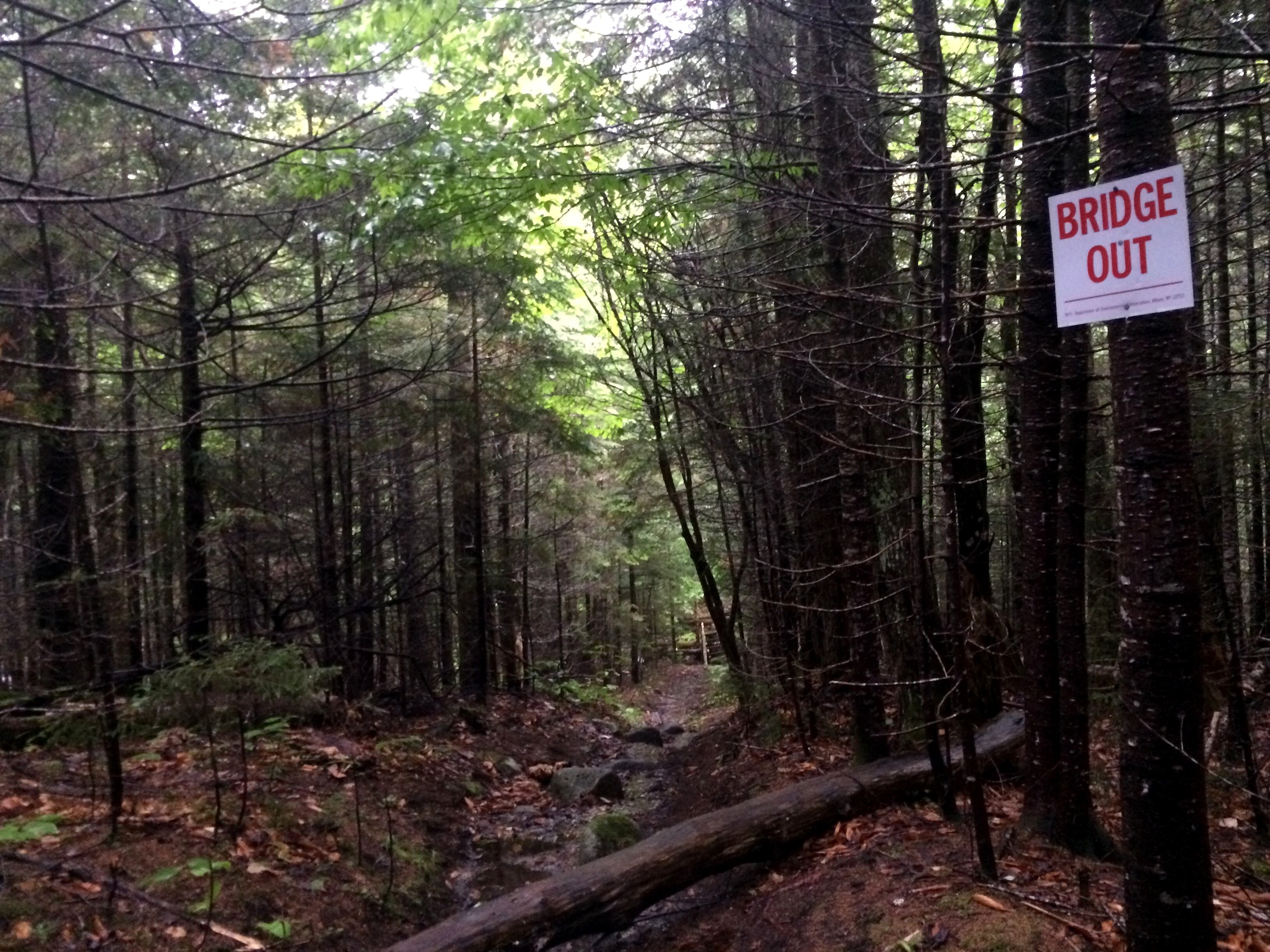
Bridge Out. Oh Joy.
My trail book said you soon cross a brook on a “good bridge”. Yep, not so much. The bridge is completely gone. The water was only ankle deep so no biggie except that my feet were now wet and stayed wet for the next 11 hours or so. A few hundred yards down I noticed there was a makeshift crossing with a plank on a rock that would come in handy on the way back.

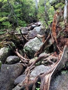
And the second bridge is Broken.
Then you cross the Santanoni Brook on an elaborate bridge with a series of log steps up the far bank. The “DANGEROUS” sign is always lovely to see. But the “bridge” part over the water was still intact. The water was already fast moving and I learned my lesson from my Street and Nye adventure and was not going to venture into that water. A quick climb under the broken section, once reaching the edge of the water, and you’re back in business. I took more time than I probably needed but wet wood is slippery and I’d rather move like a snail than have a misstep.
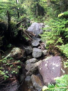
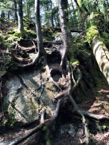
The next section was my favorite of the day. Ascending up the valley next to a beautiful series of cascades. I only stepped off for one picture – the first one – but I should have taken a few more since they got increasingly impressive. Now you get more mud and some “mini swamps” and the trail is generally wet and mud filled with great “mud bridges”. I don’t know who built them but I love that person. As my trail book calls it “unremittingly wet”. Yes it was.

Turn off to Panther herdpath
Now at 4.3 miles the path to Panther Peaks diverges L across a beaver damn. See that picture where the trail arrow is. Make note of that because it is very easy while you’re leaving the Panther trail to follow this arrow but that continues on the Duck Hole trail NOT going back down. Yeah, I did that on my descent but realized pretty quickly.
Crossing the beaver damn the trail to Panther Peak starts off easy enough and I imagine would have some views of mountains – but again all I saw was clouds. Then you enter the forest where I saw some lady slipper flowers. I thought it was fitting since I was climbing on Fathers Day and I have a very vivid childhood memory of my father showing me lady slipper flowers on the edge where our yard and woods met. Nothing like the woods to bring out memories you haven’t thought of in years.
Once you reach Bradley Pond the path starts climbing steeply over rough terrain. It’ll get your heart pumping. I had no rain for this part of the day – and even some sunshine! Allowing my cloths to actually dry from the morning rain.
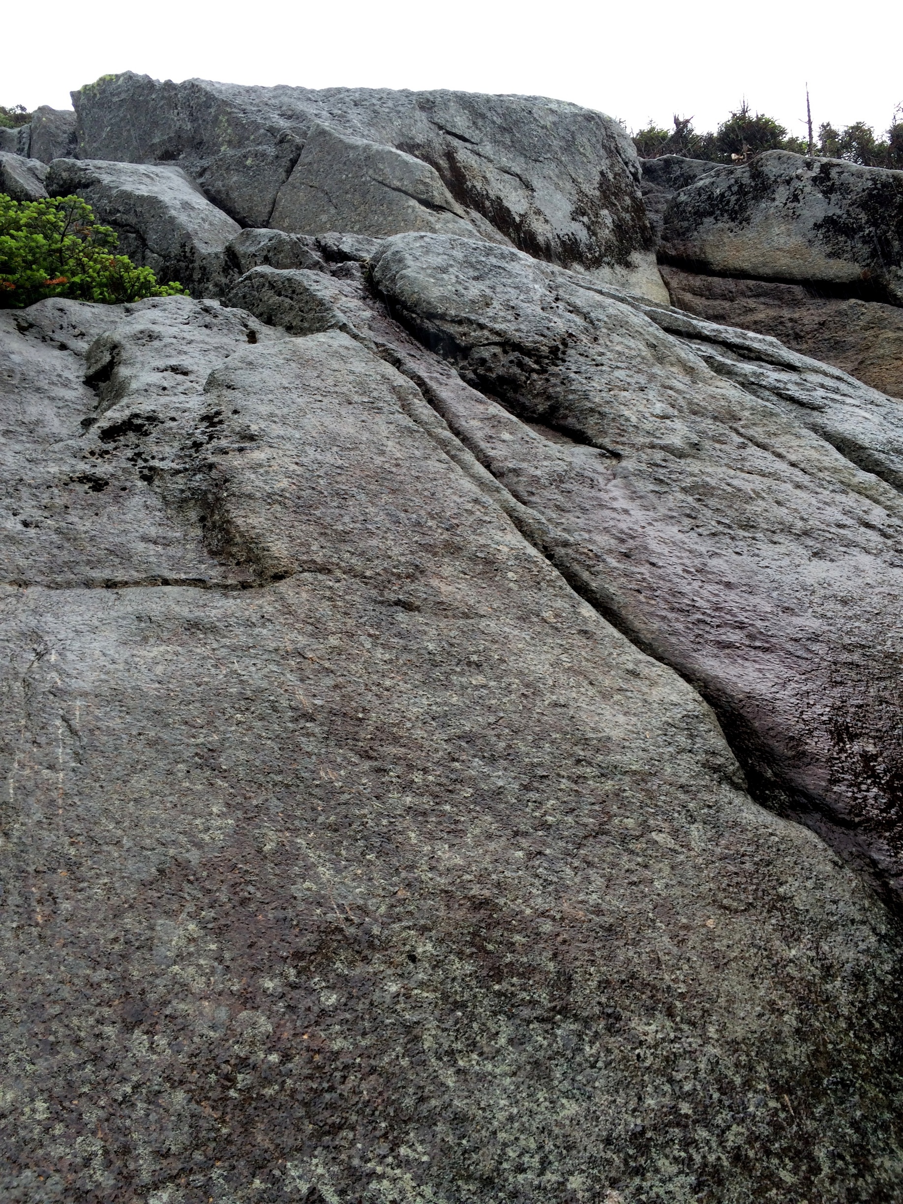
Then next 1.3 miles basically suck. And took me much longer than I thought. Nothing too challenging but a whole lot of rock-hopping, climbing and not the smoothest of terrain. More rain didn’t help. It just goes on and on and on.
Then finally you hit the crest of the ridge at a junction called “Herald Square”. Well labeled with a “HS” carved into a tree. The path to the right goes to Panther Peak – though when I climbed it there was no cairn but you can’t miss the muddy, muddy path.
Last scramble to Panther
It only takes about 15-20 min to reach Panther’s summit and is all pretty straight forward with some ascending but nothing too crazy. Just one last scramble at the end where I had my only real view for the day. At the bottom of the scramble I had a clear view but in the few minutes it took me to get to the top of the scramble the clouds had moved in and obscured my view. Damn you ADK Gods.
After summiting the scramble you walk on some level ground through a mini swamp. Seriously even the summit has swamp! And viola you are there. And by there I mean a sign in the middle of trees.
In short order, it began to lightly rain, which, quickly turned into buckets and buckets of rain with a river running down the trail. Yeah, climbing down a rock scramble while water is rushing all around me was all kinds of awesome. It only lasted 15 minutes but I hated life in those 15 minutes.
Now back at Herald Square where there are two trail options – straight or left (from the perspective from where you originally entered). It is a bit confusing. The path straight is marked with a “L” and the one to the left has a cairn. I have no idea where the “straight” path marked with a L leads but it seemed nowhere other then what would be a nice viewing ledge on a clear day. But it is a trail-less path so I might of just missed the “path”. Supposedly it’ll take you to Times Square – as does the path on the left marked with the cairn.
When you get to “Times Square” it doesn’t give you any indication you are there. And in fact after taking the right towards Couchs I second guessed myself and retraced my steps back to Herald Square and to try the other path just to make sure. I’d thought of this when I was running out of daylight and the time I wasted – but it can still be the right call to be sure vs. going off in the wrong direction – especially on unmarked trails.

Bog between Panther Peak and Couchsachraga
Couchaschraga is one of my least favorite climbs of all time. It is an ancient Algonquin name that means “Dismal Wilderness.” I would agree with the Algonquins.
You walk forever on a ridge that is pretty with the sunlight shinning in and is generally flat. Then you descend steeply (about 800 feet in elevation) that you’ll then have to climb back up. I was running short on time but wish I taken some pictures of this “dismal” section. And then you reach the bog.
My Cousin Dave (who completed his 46 last year) said it was like nothing he has seen. But he wasn’t joking. There are some decaying tree branches for you to balance on to avoid being sucked in by earth. I got through all that in short order but at the very end couldn’t quite jump to “dry land”. Testing the ground with my trekking pole and put my right foot down, no problem. Great, right? Wrong. One more step with my left foot and my entire leg disappeared into the earth. Yep. New. Life. Experience. I now know what it feels like to have mud up to my thighs. Oh joy.
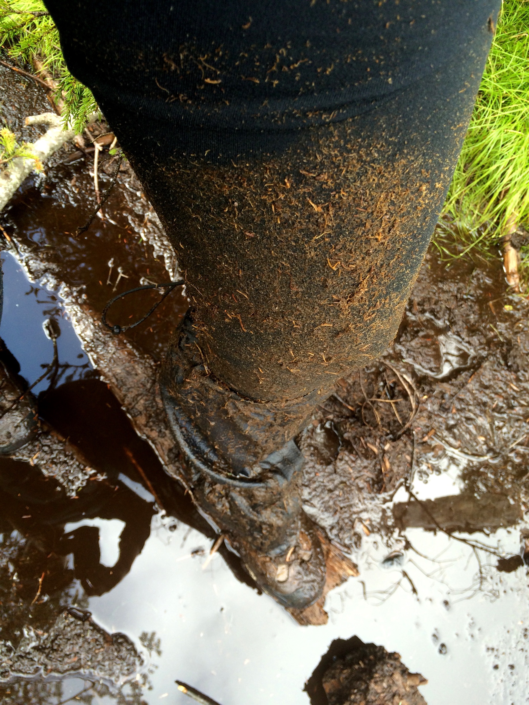
Mud up to my thighs. No problem.
It then climbs moderately at first and then some scrambles, a ridge, more scrambles, and another ridge that I remember thinking seriously am I there yet. Nope. Then two last slippery scrambles and you’ve arrived to a summit, surrounded by trees. Sure take in that view of the…trees.
Peeps weren’t exaggerating when the trek from Panther ridge to Couch’s can take two hours or more. To add insult to injury it isn’t even above 4,000 feet due to an inaccurate measurement back in the day. But tradition is tradition and is required as part of the original 46. I’ll be holding a grudge against this mountain for a while.
At that point I knew I wasn’t going to make it to the trailhead with daylight. But I wanted to be back on the main trail and past 3. 4 miles since the trail is much easier and much more defined (i.e. I can follow it in a head lamp). I made it just past the Santanoni herdpath turn off and would have been past the bridges if I hadn’t followed the damn “trail sign” at the Panther junction in the wrong, f**king direction. Just not a great feeling that you don’t have your bearings when you’re loosing daylight.
The section of the trail from from 4.3 (Panther herd-path split) to 3. 4 (Santanoni herd path split) requires close attention . It’s the hardest area to follow especially on a rainy day with some sections more rocks than trail. It appears to be a brook with cascading water and you ascend at one point even though you think you should be going down. And some re-routing of the trail makes for some confusing areas. Good thing for maps and compasses.
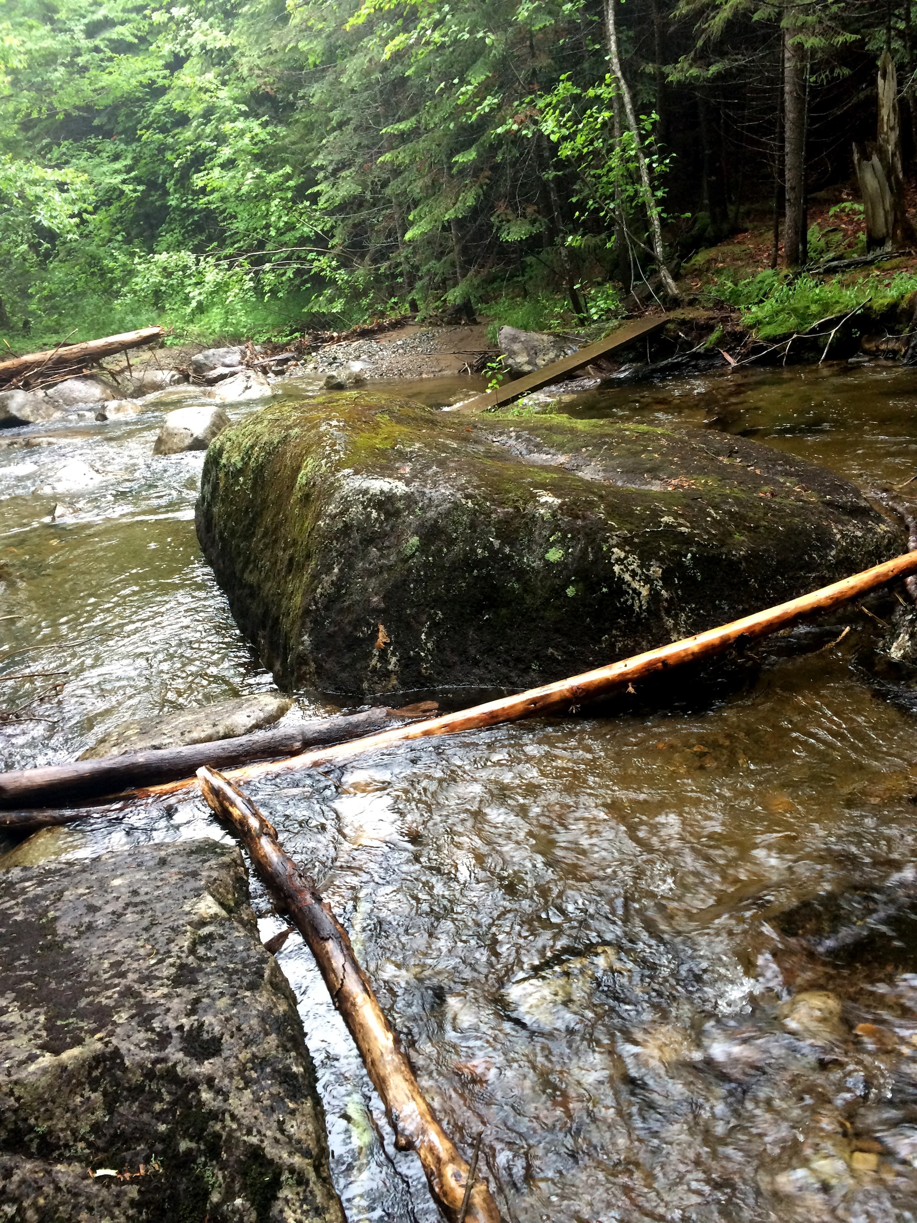
Oh but there is a plank balancing on a rock.
I will say that crossing a now very swelled brook on a slippery plank – that is balancing on a rock and bank – in the pitch dark, while it is raining, was one of the more slow moving moments of the day. Ditto when I crossed the broken bridge. I couldn’t see the water below me but the sound was deafening so I’m guessing it was pretty raging. Being above raging water with no guardrails gives me a new appreciation for those afraid of heights. But small, slow steps, and my headlamp all was safe and sound. (You hear that mom – I was totally safe).
It was smooth sailing from there. Mud filled. But generally has easy footing and easy to follow even with a headlamp. At 1.1 miles from the parking lot crossing the outlet to Harkness Lake there were hundreds of fireflies everywhere. It was all kinds of awesome. The skies had finally cleared up and the view of the stars was impressive. As tired as I was I took a breather to enjoy the fireflies, stars and sounds of frogs, crickets and the wind. I guess that is one perk to coming out in the dark.
Not my favorite of my hikes but for all my WTF moments there were also great ones. When the sun would briefly come out and stream through the trees, especially on those never-ending ridges. The birds. They were in full force and very chatty – except when we had buckets of rain. Every living creature disappeared when it rained that hard. Probably would have liked it more on a sunny day because there are some opportunities for views. On the plus side the rain made it so the mosquitoes weren’t that bad and I hear a bug net is a must have on this hike.
Note to self. If you are unpacking your pack and put your headlamp and compass on the top of the car remember to grab them before driving away. No really. Otherwise you’ll hear something fall off your care a few miles later. The good news I still have a headlamp. The bad I need to get a new compass.
For the second hike in a row I was the only one on the trail. Not a soul the whole day. Just me the rivers, wind, trees, birds and mud. Back at the trail-head no one signed in so I guess no one else wanted to be a glutton for punishment and do a mud filled hike on a crappy day.
My hike on deck was the polar opposite on a sun-filled day: Basin and Saddleback.
Panther Peak – 4,442 – order of height 18
Couchsachraga – 3,820 – order of height 46


